Excursions
In the course of the workshop, we will visit several Dutch heathland reserves in the central and northern part of our country. Here we give summary descriptions of the excursion sites. An additional excursion will be held in the plus-programme, see the separate plus-programme page for further info.
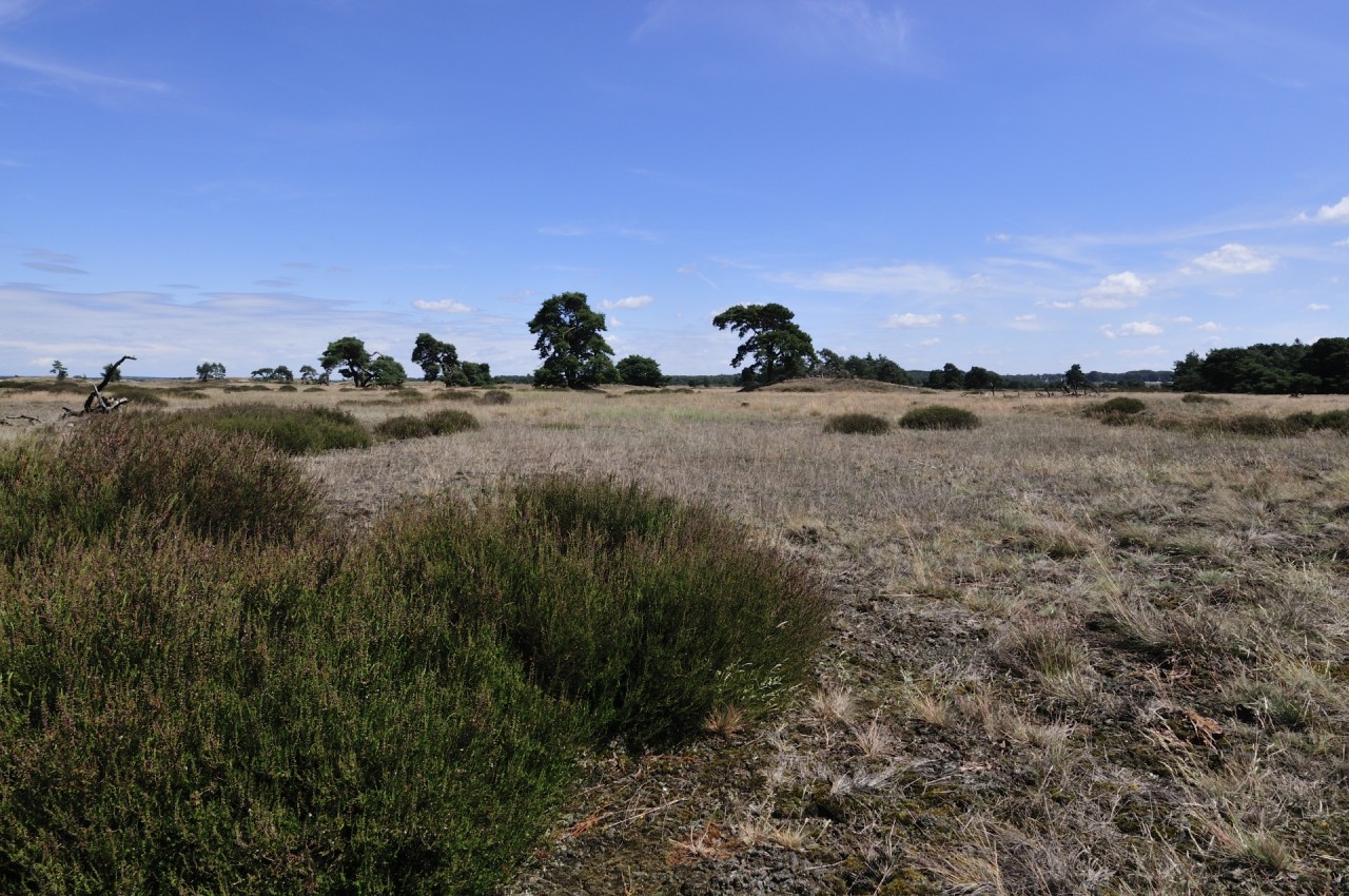
Mookerheide
Sunday evening - aug 20
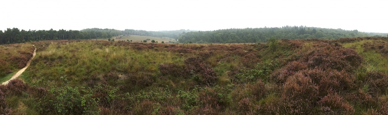
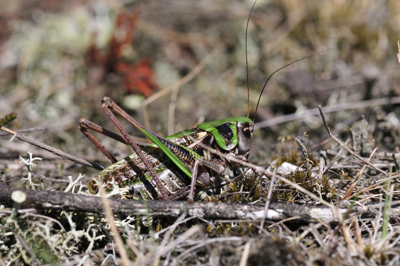
At walking distance from the hotel lies the Mookerheide. The Mookerheide is situated on the push moraine of Nijmegen from the Saalien ice age and nowadays contains only small remaining heathland remnants in the otherwise afforested hill. The heathland is situated 50 meters above sea level. Dry heathland vegetation can be found on the highly permeable course sandy material, intermixed with grass dominated vegetation on somewhat loam richer soils. The area is home to two rare species of grasshoppers (Ephippiger ephippiger and Chorthippus vagans). The 235 ha heathland area is a part of the National Park ‘Maasduinen’.
The tour leads along a five-pointed star ramp of 50 meters in diameter. It is the remnant of a defence work from the second half of the 17th century, presumably made by State forces of William III. The area is also known from the Battle of Mookerheide (1574) during the Eighty Years War between The Netherlands and Spain, which took a death toll of over 3,000 people. During the second world war, the surrounding area was also the stage of fierce combat between allied and german forces.
In summary, this historical battle grounds between the great powers of Europe is a perfect site for us to show a better approach and therefore a perfect stage for a relaxed evening walk, and to chat and reminisce with your collegues from abroad!
Hatertse en Overasseltse Vennen
Tuesday afternoon - aug 22
The Haterste en Overasseltse Vennen is situated near the borders of the city or Nijmegen. The highly characteristic undulating landscape with high wind blown dunes and ombrotrophic ponds was formed in the weichselien period, when the wind was able to form high dune ridges from sand deposited by the river meuse. Underneath these dunes, older clay and loam depositis from the Rhine create an impermeable layer, resulting in the formation of many ombrothrophic water bodies. During the second half or the 20th century, much of the area had been planted by trees, which had adverse effects on the quality of the ombrotrophic ponds. Recently, large areas of forest have been clearfelled in order to restore open heathland and to increase the flow of base poor local ground water to the ponds. As a result, the conditions for the development of sphagnum peat and accociated higher plants such as Andromeda polyfolia, Narthecium ossifragum and Vaccinium oxycoccus at the edges of the ponds have improved considerably. The presence of these water bodies also results in a high diversity and richness of species of dragonflies, including many red list species.
The area also harbours several extensively used grain fields, which are specifically managed in order to create suitable habitat conditions for nowadays extremely rare plant species characteristic for historical agricultural fields. The management of these fields is probably also the reason for the remaining presence of a population of the currently extremely endangered Wart-biter (Decticus verrucivorus).
National Park the Hoge Veluwe
Wednesday morning - aug 23
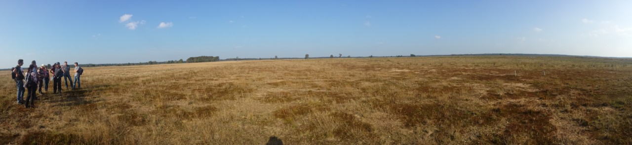
The National Park The Hoge Veluwe is one of the biggest (5400ha) and oldest national parks of the country. It was originally founded by the wealthy couple Kröller-Müller, who bought large areas of sand dunes and heathland in order to create their own private estate. Due to the financial crisis in the 20's, the couple was forced to sell most of their property to the state. Since 1935, the park is run by a private foundation, responsible for the management of the National Park.
The park is situated on the south-western flank of the largest glacial push moraine (the Veluwe massif). The park consist of aeolean deposits, smaller push moraines and sandr terraces, which define the vegetation types present. Large area's of open drift sands, xerophilic heatlands and dry heath vegetation on cover sands dominate the landscape, but sphagnum rich wet heath vegetation are also commonly present, as a result of impermeable iron pan-formations in the subsoil. Nardo-galion communities are found on the loam rich push moraine, but are currently severely threatened by increased nitrogen and acid deposition loads and subsequent eutrophication and acidification of the soil.
During the second world war, parts of the park were confiscated by the germans in order to construct a military airfield. The remains of the activities are still visible in the area, most notably in the push moraine area where the soil was severely disturbed. These disturbed sites now harbour several highly endangered characteristic heathland species such as Botrichia lunaria, Schorzonera humilis, Pyrgus malvae, Gryllus campestris and a recently rediscovered population of the presumed extinct grasshopper species Tetrix bipunctata.
Inside the park, several management and scientific experiments are being carried out, aimed at restoring the natural soil chemical properties. Most notable are the small-scaled as well as large-scaled experimental additions of mineral-rich rock-flour to the soil as a means to counteract decades of increased leaching and mineral depletion of the soil.
During the excursion, we will travel by bike through the park in order to visit these sites.
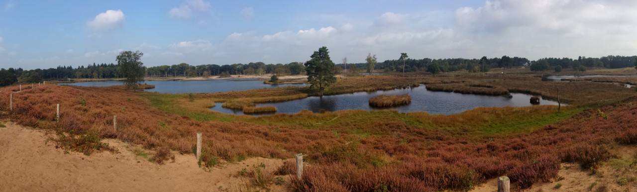
Wet Heaths of Northeastern Twente | Stroothuizen
Wednesday afternoon - aug 23
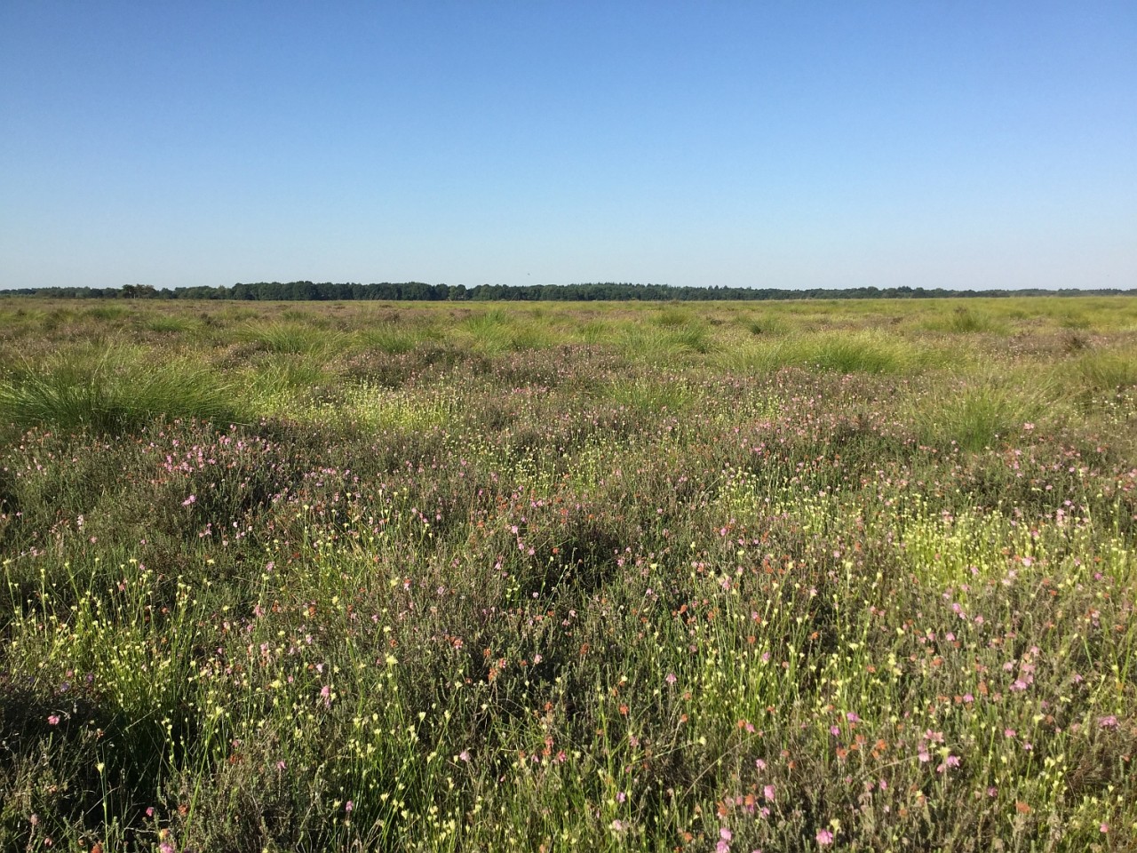
The small nature reserve Stroothuizen is a remnant of the former vast wet heathlands of Twente, a region in the eastern part of the Netherlands. It was established as a nature reserve in the beginning of the 1960s, when the surroundings were cultivated by land reclamation activities.
The reserve is part of the aeolic sand landscape, which originates from the Weichselian glacial period. This undulating landscape with subtle altitudinal differences is rich in gradients. The site conditions in these gradients, ranging from dry and wet heathlands to ground water fed small-sedge marshes, amphibic plant communities and species-rich fen meadows, are determined by hydrological processes. The lower parts of Stroothuizen are fed by base-rich groundwater originating from a deep aquifer.
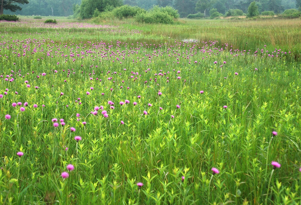
A well developed fen meadow with Circium dissectum at Punthuizen
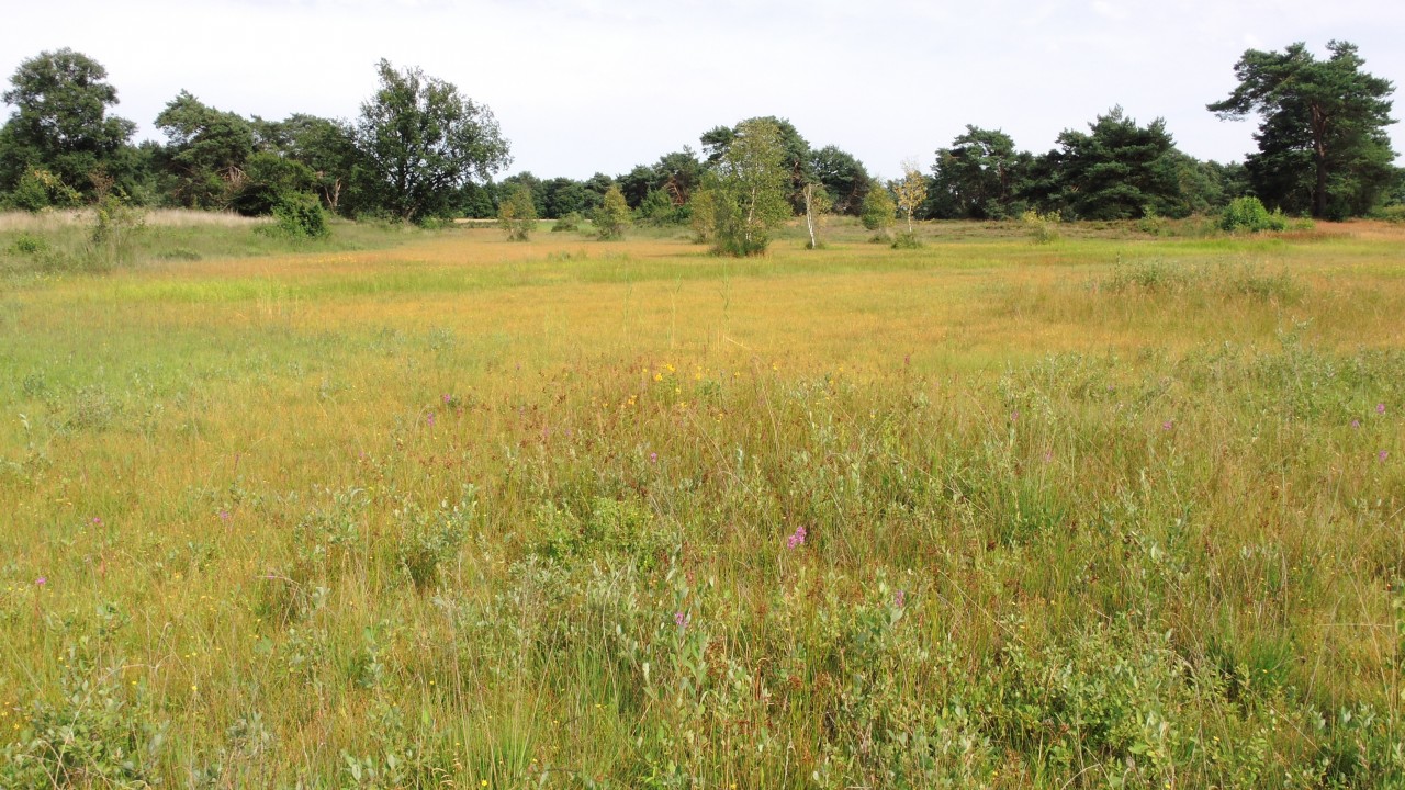
A view from the restored agricultural field to the old part of the Stroothuizen reserve
The area is rich in endangered plant and animal species, due to a prolonged and careful management of yearly mowing and hay-making. Small-scaled sod cutting was carried out in order to restore wet heathlands and other groundwater dependent plant communities. Moreover, in 1994 several restoration measures (filling of ditches, removal of drain tubes, excavation to the former soil surface of former depressions) have been carried out in an intensively used agricultural lot, aiming at the restoration of the former wet heathland landscape.
During the excursion we will pay attention to the hydrological functioning of this exceptional wet heathlands and show the long-term results of regular management as well as restoration measures.
Dwingelderveld heathland reserve and Noordenveld restoration site
Thursday afternoon - aug 24
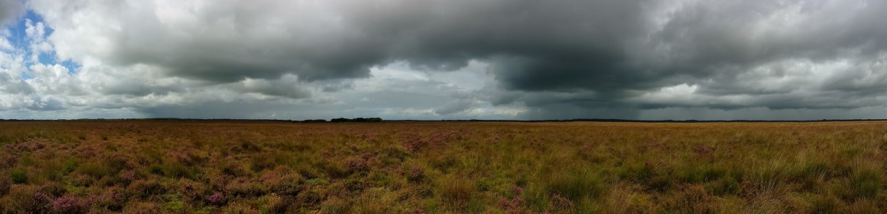
The Dwingelderveld National Park is one of the few larger heathland remnants that survived in the Dutch pleistocene region. It is the largest heatland remnant of the Province of drenthe and is almost 4000 ha in size. The reserve is unique in Europe, as it harbours the largest area of wet heath (Ericion tetralicis) to be found in Europe. Next to wet heath, dry heath (Genisto callunetum), acidic fens, sphagnum bogs and both wet and dry sileceous grasslands (Nardo-galion) vegetation types are also present in the area, often very closely intertwined to one another.
The unique interchange between these vegetation types is due to the lithology of the subsoil and its influence on the hydrology. During the last stages of the Saalien glaciation, the retreating ice sheath deposited large quantities of ground moraine consisting of fine silt, loam and gravel. This layer of boulder clay has subsequently been covered by wind-blown cover sands of varying thickness, resulting in a undulating langscape of sandy ridges and gulleys. Other visible glaciation features are a small kame hill in the center of the area, and several kettle lakes. All of these features gave rise to the high variation in vegetation patterns that characterize this area.
Another aspect of the precence of boulder clay is its potential to supply base cations to the soil. Due to this, populations of nowadays very rare plant species such as Arnica montana, Polygala serpyllifolia, Pedicularis sylvatica and Gentiana pneumonante are still present in the area. Due to the high variation in site conditions, the park is also rich in fauna, and home to rare species of grasshoppers, ants, bees, butterflies, ground beetles, reptiles and birds.
The recently restored Noordenveld area, a former intensively used agricultural enclave in the center of the National park will also be visited. In the Noordenveld project area, several experiments aimed at enhancing the restoration of heathland vegetation types (Genisto-callunetum as well as Nardo-galion communities) have been carried out.
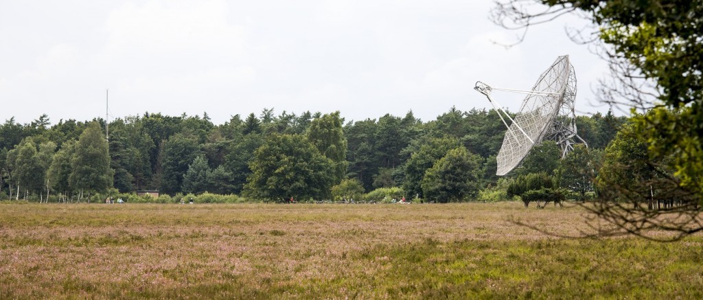
Finally, the Dwingelderveld National Park is also famous for its radio-telescope, responsible for the discovery of two sister galaxies of our own milkyway and subsequently named after this telescope (Dwingeloo 1 and 2). A fine example of ancient and modern history and technology blending in perfectly.